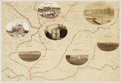
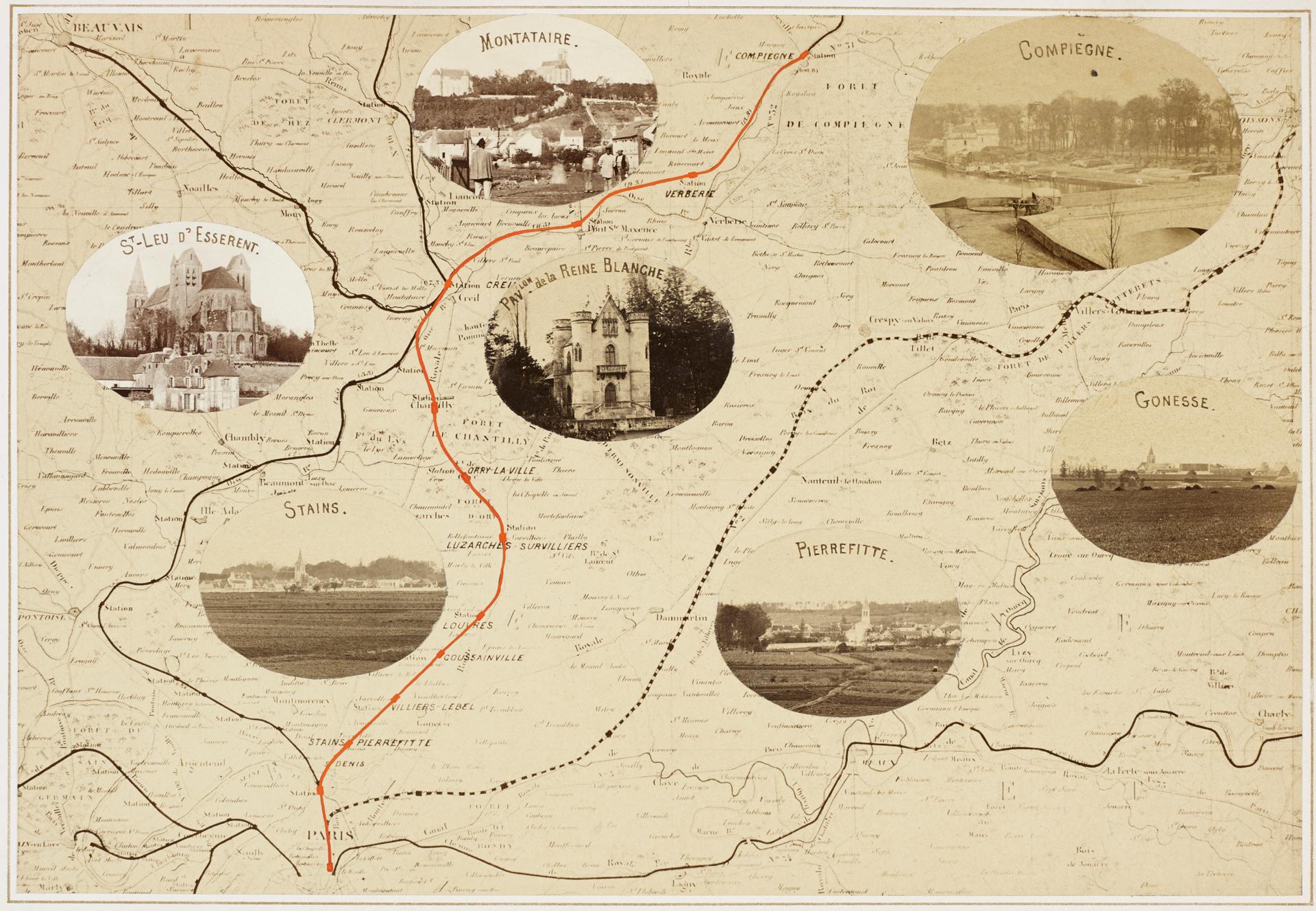
Carte illustrée
Photograph
Carte illustrée
From the album Chemin de Fer du Nord: Ligne de Paris à Compiègne par Chantilly
ca. 1860-1861
Albumen silver prints
Image: 6 5/16 × 9 3/16 in. (16 × 23.4 cm)
Mount: 9 1/16 × 11 1/8 in. (23 × 28.3 cm)
Gift of Eastman Kodak Company, ex-collection Gabriel Cromer
1974.0053.0001
Inscriptions Printed in gilt with blue watercolor capital letters, mount recto, TC: Carte Illustrée.
Printed in gilt, mount recto, BC: Echelle en Kilomètres. - [scale in kilometres]
[Line border around image printed in gilt]
Inscribed in black ink, on each oval print applied to map, TC of each: Montaire. \ Compiègne. \ St-Leu d'Esserent. \ Pavlon. de la Reine Blanche. \ Stains. \ Pierrefitte. \ Gonesse.
Inscribed in red, on image of map, C: [line following Paris to Compiègne railroad]
Inscribed in pencil, recto, BC: B179b
AlbumAlbum-Page